Curriculum
River/stream naturalness refresher training
River/stream Refresher Training
0/11Practice
0/7Why assess river/stream naturalness?
Natural function is a key feature in identifying freshwater priority habitats because it generates a dynamic mosaic of high-quality freshwater, wetland, and terrestrial habitats. Having lots of different features in a watercourse provides a range of environments and foods for a larger range of species. This includes rare habitats that are home to rare and threatened species. Freshwater habitats should therefore function as naturally as possible to support biodiversity and protect species that depend on these unique habitat mosaics.
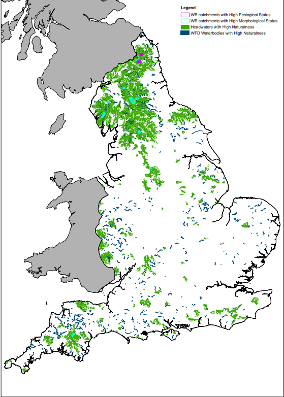
Discovering Priority Habitats aims to assess the natural health of understudied waterbodies that are usually missed by other monitoring methods. For running waters, this generally means our smaller streams and tributaries that form ‘headwaters’, the beginnings of larger watercourses. Natural function is evaluated via ‘Freshwater naturalness assessments’, a type of visual survey that assesses how naturally functioning a particular watercourse is.
Each survey conducted is added to the freshwater naturalness database, a key citizen science dataset that can be used for a range of different monitoring purposes at local and national levels. However, the primary purpose of collecting data is to refine and update the priority habitat maps. New information will be reviewed regularly and decisions will be made about which sites to add to the maps and (where needed) which to remove. All recorded sites (both good and bad) are evaluated during Natural England’s updates to the priority habitat maps, while sites in poorer condition also have the potential to be considered during restoration action planning.
The priority river and lake maps add further value to protection under the Water Framework Directive by providing additional recognition for our most natural rivers and lakes. This is important because headwater streams, riparian habitats, and habitat naturalness currently have no explicit protection under the Water Framework Directive. However, sites on the priority habitat maps are recognised in planning and permitting processes. This means they will be considered during planning and policy changes and help protect priority rivers and lakes from further losses of naturalness and the cumulative pressures facing our environment.